Mapping of Stratigraphy, Bedrock, Groundwater, and Faults
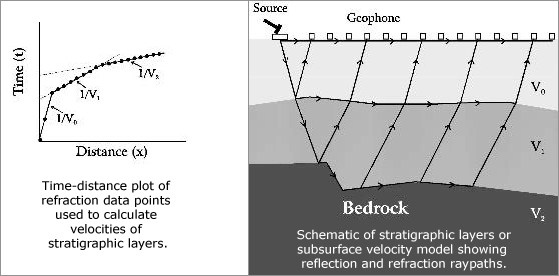
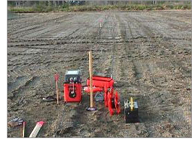
Seismic refraction is used for investigating subsurface ground conditions utilizing surface-sourced seismic waves. The acquired data is computer processed and interpreted to produce models of the seismic velocity and layer thickness of the subsurface ground structure. This tool can be used to measure bedrock depth and overburden thickness, locate geologic structures, and define ancient landfill sites.
Applications
•
Determine depth and dip of bedrock
•
Determine competence of bedrock (for foundation design and rippability analysis)
•
Determine depth to groundwater
•
Map stratigraphy
•
Map faults and fracture zones
•
Calculate engineering properties of the overburden
•
Calculate material elastic constants (e.g., shear modulus, Poission’s ratio) from the shear and compressional velocity data
Advantages
•
Fast field operation, can cover large survey areas inexpensively and rapidly
•
Typically requires less time and expense than comparable seismic reflection methods or drilling
•
Estimate material properties from acquired seismic velocity data
•
Greater vertical resolution than electrical, magnetic, or gravity methods